
One of the most interesting border intersections we found was that of place and time in relationship to the cards, either individual cards or configurations of them. Geography and time intersect in nearly limitless configurations, each juncture carrying with it new possibilities for research and meaning-making. Even as this is one of the most productive places of research, we find it increasingly difficult to conceptualize how the digital platform will function with the myriad ways they need to be catalogued. Therefore, how we record place and time is still conceptually evolving within the Omeka platform.
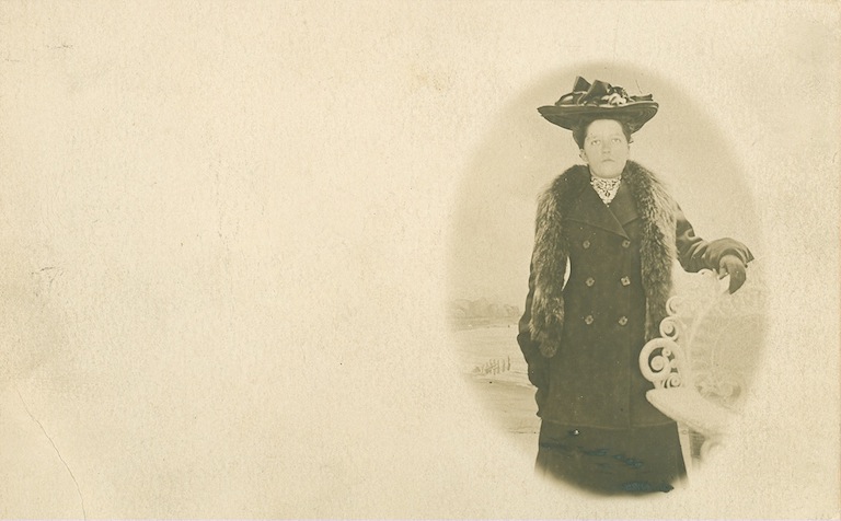
Early in our thinking we realized how complicated it would be to record a card's location and date—two of the original Dublin Core categories—because of the multiplicity of each. Consider the card on the right. Since the Dublin Core only allows for one date and place, we originally defined place and time as the location and date of the card's production. However, that information isn't often found on the cards, so those categories often remained blank even though other obvious places and dates were on the cards, namely the location of the image on the front of the card and the date the postcards were written and/or sent. Although we include that information in the "Item Metadata" section, the Google mapping and timeline components of Omeka are attached to the Dublin Core. Both of these add-ons provide wonderful mapping and timeline displays that could be a great help in researching and reporting on a subject.
But even those aren't the full extent of the options we had in front of us. As we got deeper into the research, we realized that location could also include where the card was printed, distributed, or sold, or it could be the location of the photographer/artist, that of the publisher, or even where we acquired the card. The same is true of the date: when was the image created; when was it printed, purchased, written on, sent, or received; and when did we acquire it, or when was it entered in the archive, or when was it last used? All of these questions are legitimate, and the Dublin Core system of archive classification within the Omeka system doesn't allow us anywhere near the nuance we need to record these places and dates. Since it's at intersections of geography and time that we find meaningful connections, it's especially frustrating that the system doesn't allow multiple, overlapping, or intersecting times and places. For instance, we'd love to visually represent multiple points on the map for a single card (perhaps color coding them for different types of geography) or trace the temporal circulation of a single card. While we can do that manually, the system doesn't currently have the affordances to represent or help us keep track of these intersections.
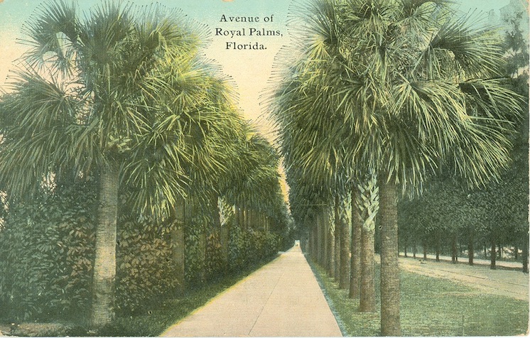
Geography and time have already played an important role in the organization of the current archive and will continue to evolve as researchers use the site. Mr. Smith, the collector from whom we have acquired many of the cards, largely organizes his cards geographically, which in part stems from his involvement in World War II. Many of his early acquisitions were from places that he or his brother traveled during the war. Because of this, many of the cards in his collection have a personal connection to his own history and experience. We assume that many other collectors approach cards in similar ways, making personal connections to geography and time, and we are in many ways no different. Our interest in Florida postcards stems from our physical location within the state, though other criteria have been more significant for our acquisitions. In fact places usually overlap with other criteria that become critical to the vision for the site. Since social issues and historical events also play into our initial acquisitional interests, many of what we think are our most interesting cards are located in temporal pockets in the first half of the twentieth century. Seeing representations of race and gender, for example, evolve over decades of postcards provides a window for research that many students are finding particularly appealing for their research projects.
Since our vision for this archive was not about comprehensive coverage, we look for cards that would match up with a variety of rhetorical interests that intersect along the border of geography and time. Thus far, we have been more interested in acquiring older cards than more recent ones. As we mentioned earlier, we have also focused more on local Florida cards than other locations, though both continue to expand. Each time we are looking at a set of cards, we have to consider the kinds of work that can be done with the cards and if the cost is worth what we hope to gain from purchasing them.
One example is our decision to purchase a set of postal cards, some of which date back into the 1880s. Postal cards are pre-stamped, mostly blank cards on which people wrote messages to send through the mail. Unlike postcards, postal cards have no picture on the front. As we considered this purchase, we factored in the age of the cards, the messages written on them, and the absence of an image. Ultimately, we decided to purchase those cards, knowing that while they may not be appropriate for certain types of research that focus on the front image, they could be of great importance for topics such as the evolution of cards, their circulation, and/or an exploration of written messages on the cards. We also have a leaning toward cards that have interesting representations of social issues such as race, class, and gender. Not wanting to assume the relevance of our values for future projects, we continue to negotiate the acquisition of new cards in ways that we believe will provide the best opportunities for future researchers in our local environment.
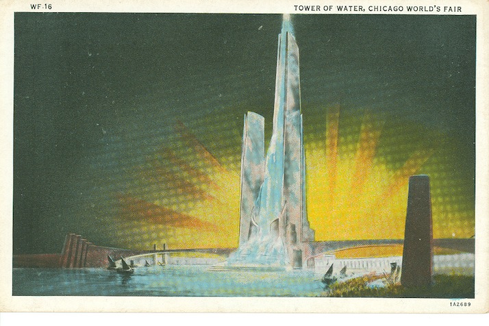
One way we will imagine the relationship of geography and time is to track how this border intersects with the interests of those who use the archive. The clearest evidence of this will be the exhibits researchers have created within the archive. Exhibits are virtual collections of cards that researchers put together. The Omeka platform allows contributors of the site to create and modify their own exhibits, adding images and texts to those of the postcard images. At the time we are writing this webtext, we and our students are the ones who have created exhibits on topics ranging from sexist humor and representations of Native American authenticity to exhibits of Curt Teich Florida Keys cards and the World's Fair. The World's Fair exhibit, which you can link to from the image to the right, is a good example of an exhibit that combines video, images, and the textual research in relationship to a topic. We could give any researcher who wanted access the ability to create an exhibit within the site for his or her research project. This is one way we have conceptualized the site expanding: Instead of adding an infinite number of cards, it can expand through people adding their research to the archive that will in turn be visible to future visitors of the site. As students and other researchers complete exhibits within the archive, we will see where within the site their interests lie and continue to build into those areas that are productive points of meaning-making for them.
Other postcard sites use social media indicators (e.g., liking, commenting, counters, and thumbs up) to measure interests in cards. While these are not readily available yet in the Omeka platform we are using, more add-on modules are being created, and we may be able to layer them onto the archive if they will help us monitor interest.


